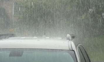
A Special Weather Statement has been issued by Environment Canada due to strong winds, heavy rain, and thunderstorms in the forecast.
Environment Canada said strong winds, heavy rain and thunderstorms are expected beginning late on Wednesday afternoon or early evening and continue overnight.
According to the national weather agency, wind gusts of 70 to 90 km/hr are anticipated, with higher gusts possible in thunderstorms.
Forecasters added that rainfall amounts in excess of 40 mm and a risk of severe thunderstorms are also expected.
Environment Canada noted watches or warnings may be issued closer to the event as the path of this low pressure system becomes more certain.
The Lower Thames Valley Conservation Authority (LTVCA) has also issued an early notice of the potential for flooding based on the forecasted heavy rain that could lead to high runoff.
The LTVCA said many areas of the watershed have seen significant rain over the last few days and ponding, standing water, and localized flooding could be expected around the region.
"Smaller watercourses could rise and some could spill their banks into adjacent low-lying areas," said the conservation authority. "Based on the current forecasts, the Thames River is not expected to rise significantly in response to the rain."
People should take extra caution and avoid the watercourses, ditches, and streams that are running high, noted the LTVCA.
"The combination of slippery banks and fast-moving water can be dangerous," the LTVCA said. "Standing water can also present its own unseen hazards. Children, pets, and livestock should be kept away from the water."
Officials said they will continue to monitor the situation and update this flood advisory when necessary.
This advisory will be in effect until Friday morning.